
Why the north is full of holes
The northern third of Puerto Rico, from Loíza to Aguadilla, is karst: limestone laid down under the sea, lifted, and dissolved by rain over millions of years into the conical hills (mogotes) you see from PR-22, the sinkholes between them, and the cave systems the rivers carved underneath. The Río Camuy runs underground for miles. Guajataca is pure tower karst. The Tanamá valley in Utuado was made a national park in 2004 specifically to stop quarrying. Showcaves: Guajataca karst
Río Camuy Cave Park: closed, with a promise
The island's flagship cave park has been closed to the public since 2023, after a run of interruptions that started with Hurricane María in 2017. In October 2026 the DRNA secretary said it will reopen partially before the end of the year with a new online ticket system and separate resident and visitor prices, but as of October 19 there was no date, and the mayors of Camuy, Hatillo and Lares were asking the legislature to hand the park to the Tourism Company instead. Several blogs still describe it as open; they are wrong. El Nuevo Día, October 10, 2026 Metro PR, October 19, 2026
What you get when it reopens, going by the last operating season: a walk down to Cueva Clara, a chamber about 700 feet long and 215 feet high, with the Empalme sinkhole opening 200 feet overhead, and a lookout over the Tres Pueblos sinkhole, 650 feet across with the river 400 feet below. The last published prices were $18 adults, $13 children 4 to 12, $9 seniors, $4 parking, tours by reservation Wednesday to Sunday. Expect the new prices to be higher for visitors. The park is at PR-129 km 18.9, exit 77B from PR-22. Platea PR: 2023 reopening terms

Cueva Ventana: open, guided, worth it
A limestone cave in Arecibo that runs clean through a hill and opens, at the far end, onto a cliff above the Río Grande de Arecibo valley: the "window." It is private, guided only, and the guides are biologists who stop for the bats, the Taíno context and the petroglyphs on the way. About 90 minutes door to door, 45 of them walking.
- Open seven days, 9 am to 5 pm, last tour at 4. Reserve online; walk-ups wait.
- Adults $29 plus tax, children 3 to 10 $10, family packages from $99. Under 3 not allowed. Helmet and torch provided; you sign a waiver.
- PR-10 km 75, Hato Viejo, behind the gas station. About an hour from San Juan via PR-22 then PR-10 south, exit 75B. Free parking, restrooms and a snack bar.
- Discover Puerto Rico's article still says the cave is "temporarily closed" and quotes $19; that page is stale. Trust the operator. Cueva Ventana (operator) Puerto Rico Day Trips, October 2026
Cueva del Indio: free on paper, a fight on the ground
A sea cave in the cliffs at Islote, Arecibo, with Taíno petroglyphs on the walls, where the Atlantic booms up through blowholes. It is a DRNA nature reserve and an archaeological site, and since 2016 the public paths to it have been fenced by the adjoining landowner, who charges to park and enter. In July 2025 a court agreement obliged DRNA to guarantee free, safe public access and to buy or expropriate the land. In October 2025 a community group reported the fences back up, the signs destroyed, and three tourists injured on the shoreline route when waves pinned them against the wire. In August 2026 the judge fined DRNA and set deadlines. San Juan Daily Star, July 2025 El Nuevo Día, August 2026
What that means for you: expect a private lot that charges a fee, and do not try the rocks along the shore to avoid it. The cave itself is reached by a steep ladder and the rock is sharp and wet. Real shoes, no small children, no high surf days.
Caving with a guide
- Cañón de Tanamá
River caving, tubing through a cave, body rafting and rappelling in the Tanamá gorge. Operators include Aventuras Tierra Adentro, Tanamá River Adventure, Tanamá Tours and Cacique EcoAdventures. Pick one with helmets and life jackets in the photos, and cancel if it has rained upstream. Discover Puerto Rico: caves (Spanish)
- Cavernas Las Cabachuelas
A Taíno-occupied cave system opened to visitors by a local cooperative, CABACOOP, and the town's cultural center. Small groups, local guides, less polished and more real than the big attractions.
- Cueva del Viento
Free and unlit, 40 steps down. Status unconfirmed since the 2020 closure; details on the hiking page.
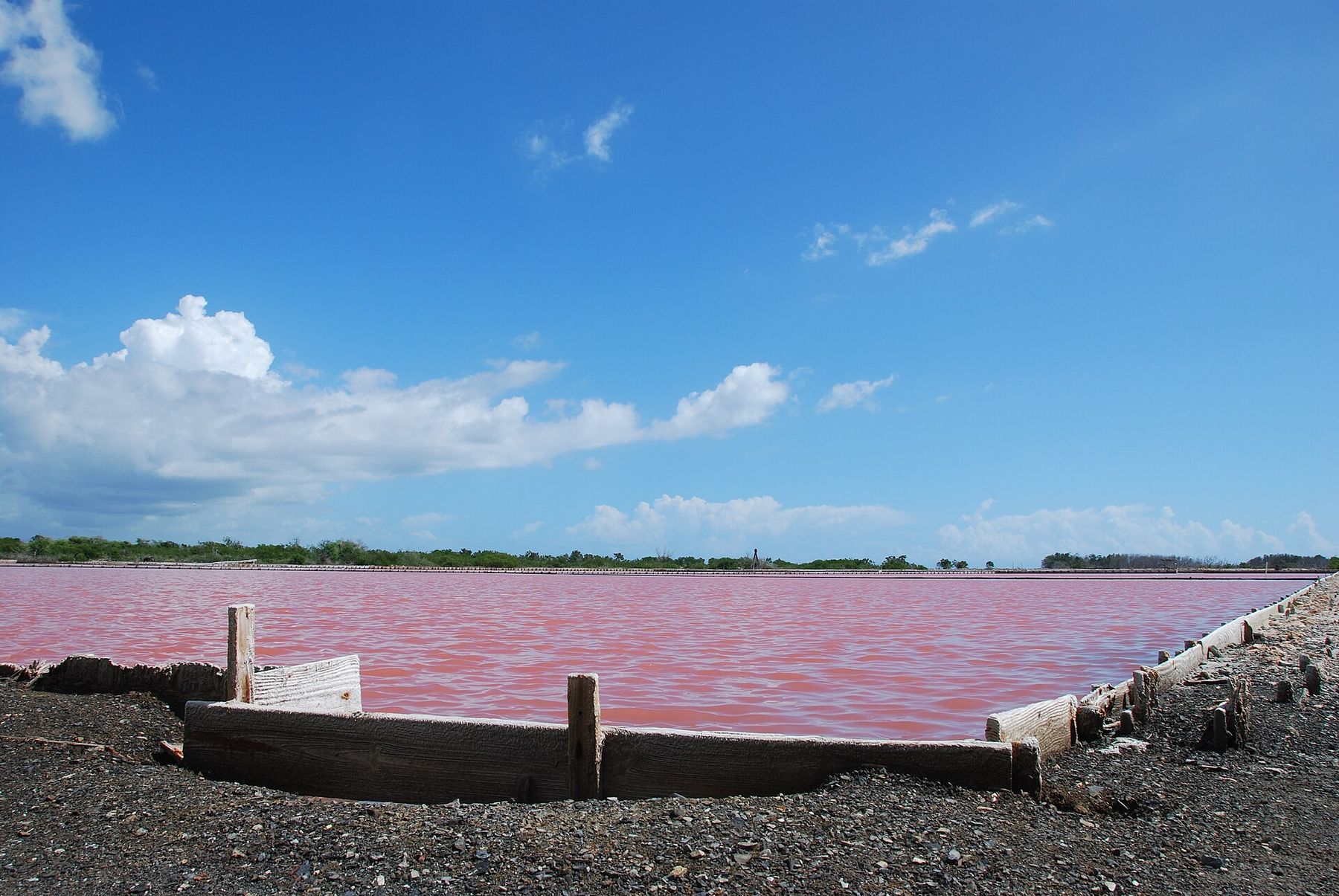
The pink salt flats of Cabo Rojo
At the island's southwest corner the land narrows to a Y-shaped spit of limestone and salt lagoons that turn pink, sometimes white, as the water evaporates. Salt has been harvested here for centuries and the flats are still worked. The US Fish and Wildlife Service runs the Salt Flats unit of the Cabo Rojo refuge: three short trails through mangroves and dry forest, an observation tower open Monday to Saturday 8 am to 3:30 pm, and an interpretive center across the road, Wednesday to Saturday, that tells the salt-mining story. Free. This is also the only place on the island where snowy plovers nest. USFWS: Cabo Rojo refuge
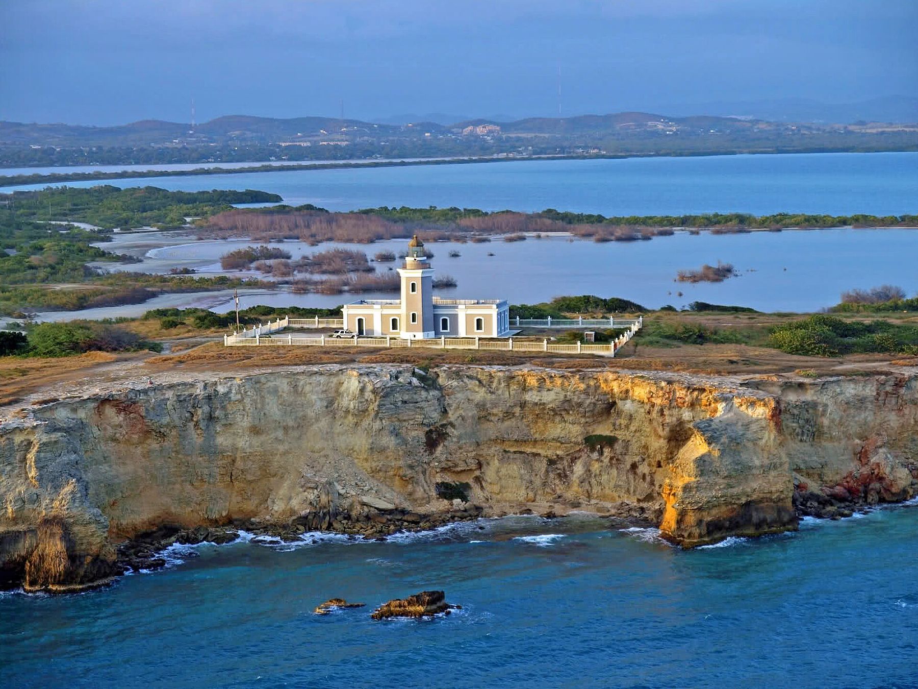
Beyond the flats the road turns to dirt for the last kilometer and ends at Faro Los Morrillos, an 1882 lighthouse 200 feet up on the cliffs with Playa Sucia, the white crescent everyone photographs, below it. The lighthouse interior was closed as of our last check; the view is the point. No shade, no water, no lifeguard, and no guard rails at the cliff edge. Go on a weekday, early, with water. Discover Puerto Rico: Cabo Rojo
Mining in Puerto Rico: the short true story
You will see "mining" on lists of things to do. There is no mine to visit and no legal recreational gold panning, so here is what actually happened and where to touch it.
- Gold, 1509 to 1579. The Spanish found placer gold in the rivers draining the Luquillo mountains and the north coast valleys, and for a few decades it was the colony's whole economy; about 1.2 million troy ounces by one compilation of federal reports, worked by enslaved Taíno and African labor. The placers ran out, the Indigenous population collapsed, and by 1580 the island had turned to sugar and ginger. Small attempts in the Luquillo rivers continued as late as 1918 and failed. US Forest Service: El Yunque history Compiled USGS and Bureau of Mines reports
- Copper, 1960s to 1995. Geologists mapped porphyry copper under Utuado, Adjuntas and Lares. In the late 1970s the government approved an open-pit complex across more than 35,000 acres. A community group in Adjuntas, Casa Pueblo, fought it for fifteen years, and in 1995 the government blocked the mines and in 1996 turned 748 acres of the concession into Bosque del Pueblo, the island's first community-managed forest. Its founder, Alexis Massol González, won the Goldman Environmental Prize for it in 2002. Goldman Prize: Alexis Massol González
- Today. Minerals belong to the Commonwealth and need a lease signed by the DRNA secretary and the governor; nobody has one. El Yunque is a national forest where mining is effectively banned. If someone offers you a gold panning tour, ask where the permit is.
Where to touch the story. Casa Pueblo in Adjuntas (30 PR-5516, open from 8:30 am, by donation) has the photo archive of the fight, a solar lab, and the roastery for its own Madre Isla coffee; tours of Bosque del Pueblo are booked ahead at 787-829-4842. The Cabo Rojo interpretive center covers the salt industry. And on the mountain road through Jayuya, La Piedra Escrita and the Museo del Cemí show the people who were here before any of it. Platea PR: Adjuntas guide